Historic Texas Maps
CMS, Information Architecture, Wireframes (UX/UI), Art Direction, Development, Accessibility
Visit website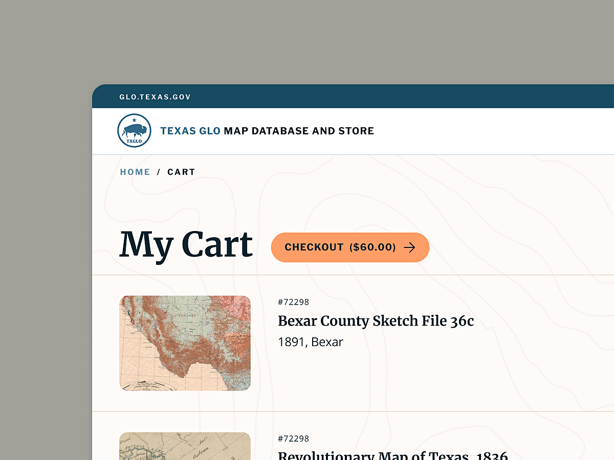
The Texas General Land Office, established in 1837, holds an archive of over 40,000 historical records consisting of land grant records and maps dating to the 16th century that detail the passage of Texas public lands to private ownership.
Many of these documents continue to be used even today by surveyors, land men and others researching land ownership. The rich primary source material also makes the Archives a haven for genealogists, historians, archaeologists and students, where they can purchase reproductions online.
GLO's presence online was dated and lacking in functonality. They approached us to help enhance their digital output and migrate data over to our collections management software - Qi.
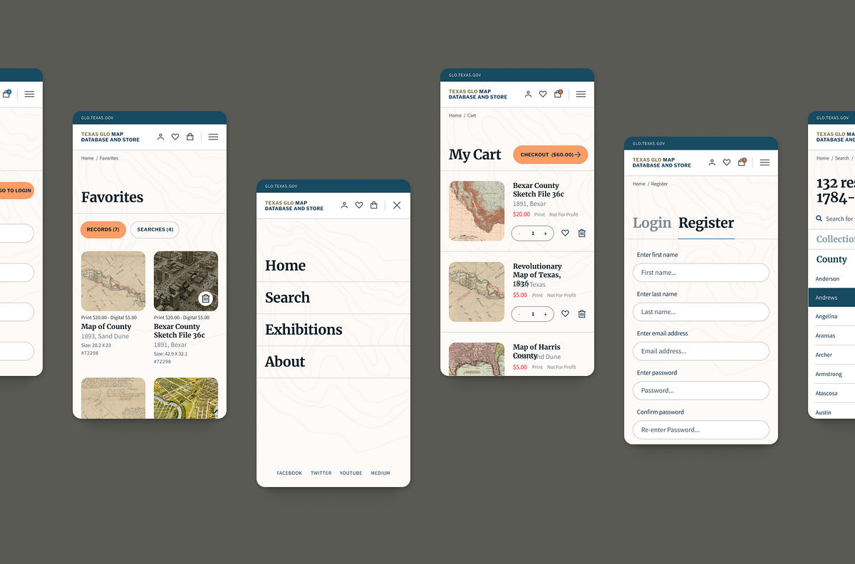
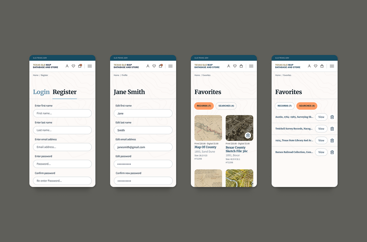
We created a digital system to catering to their main user type, researchers, allowing them to favourite records and save searches. We also provided a modern shopping system that gave users the option for personal and commercial reproduction licensing for both print and digital.
We also helped to create a platform to engage with their audiences through online exhibitions.
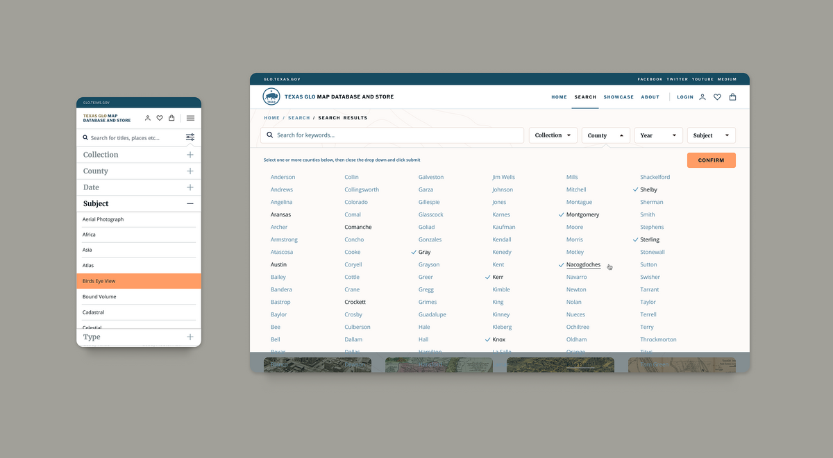
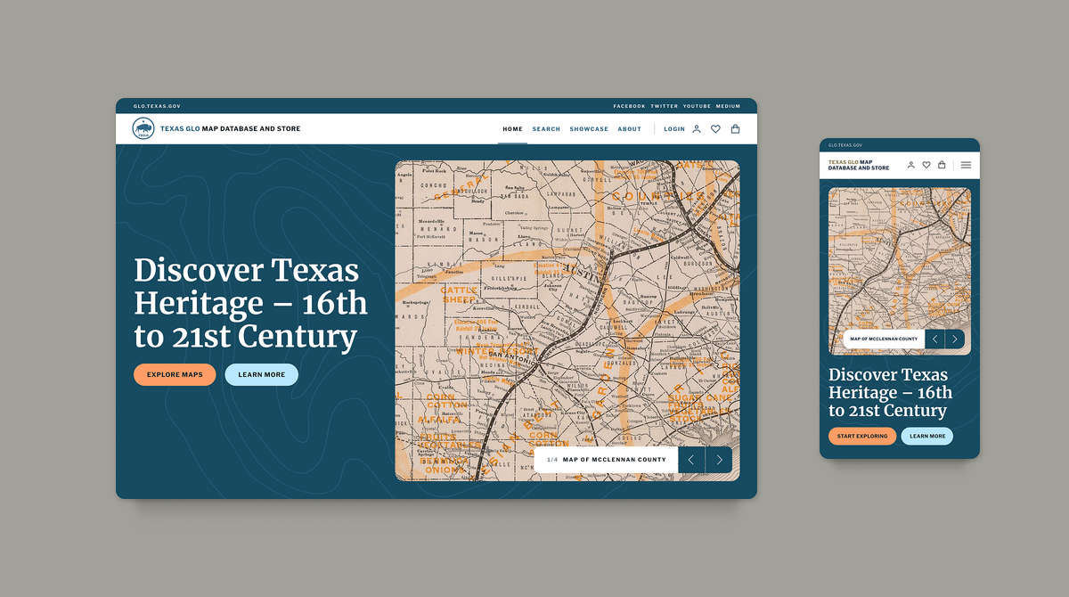
We created multiple entry points for audiences to follow paths to help guide their experience when accessing the collection of over 40,000 map and documents.
Staff at GLO have dynamic content to update and edit at any time, empowering them to focus on key content when necessary and create a curated experience for users.
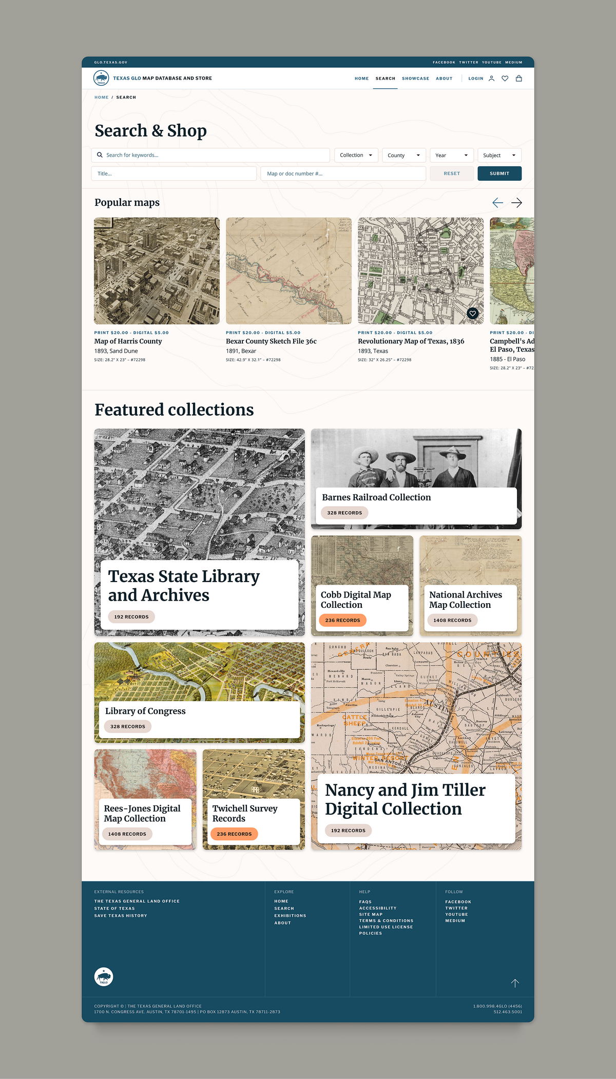
Audiences can create accounts to save their delivery address information, as well as add maps to their 'Favorites' and save searches they make in the collection to re-access at a later date.
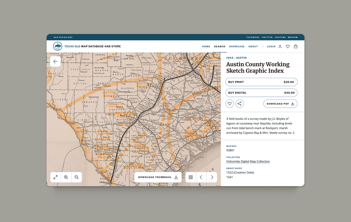
Item pages act as both a historic collection record and a commercial product, where users can add the item to their cart for purchase.
Users can purchase both a digital and print copy of an item, and choose whether the purchase is for private use or commercial use.
A third party integration with IIIF means that the intricate detail in each map can be greatly zoomed-in to allow users to analyse the map and rotate it.
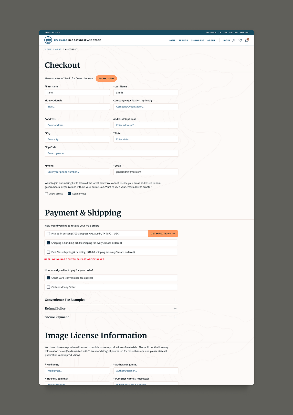
The shop system is integrated with GLO's government platform to handle payments, keeping track of payments in our Qi software and creating a duplicate record for each purchase, where staff can process orders and review commercial-use reproduction requests.
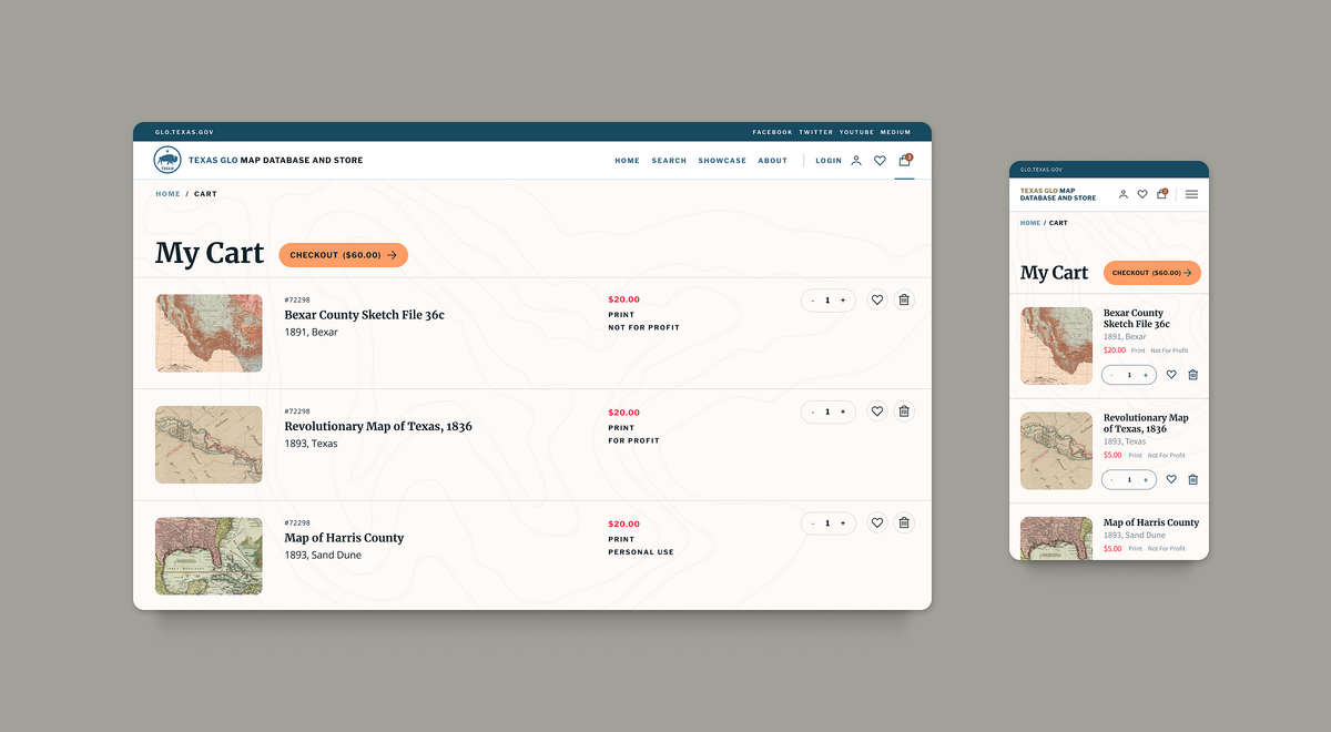
The checkout system includes auto generated input fields dependent on the type of license-use a user has selected when adding to cart.
This form helped to increase productivity for staff and simplify user-processes for gathering digitised information, where previously this was accomplished with an emailed PDF for the user to complete.
Related
Asia Art Archive
Crafting the digital presence for a unique repository of contemporary art materials
Kemper Art Museum
Harnessing art, education and research to enhance digital engagement at the Kemper Art Museum
Western Carolina University
Creating a space for public access to the rich cultural resources of Southern Appalachia